The best ocean-view hike in Los Angeles. Lush canyon, panoramic Pacific views, free parking, and one of the few Westside trails open after the Palisades Fire.
✅ Trail Open: February 2025
The January 2025 Palisades Fire closed most iconic Westside hikes. Temescal Canyon is shut down indefinitely. Will Rogers has major closures. But Los Liones sustained only minimal damage. State Parks cleared the trail in March 2025. Recent hikers confirm it's open and lush with new growth. This is the premier Westside ocean-view hike in LA right now.
What It Is
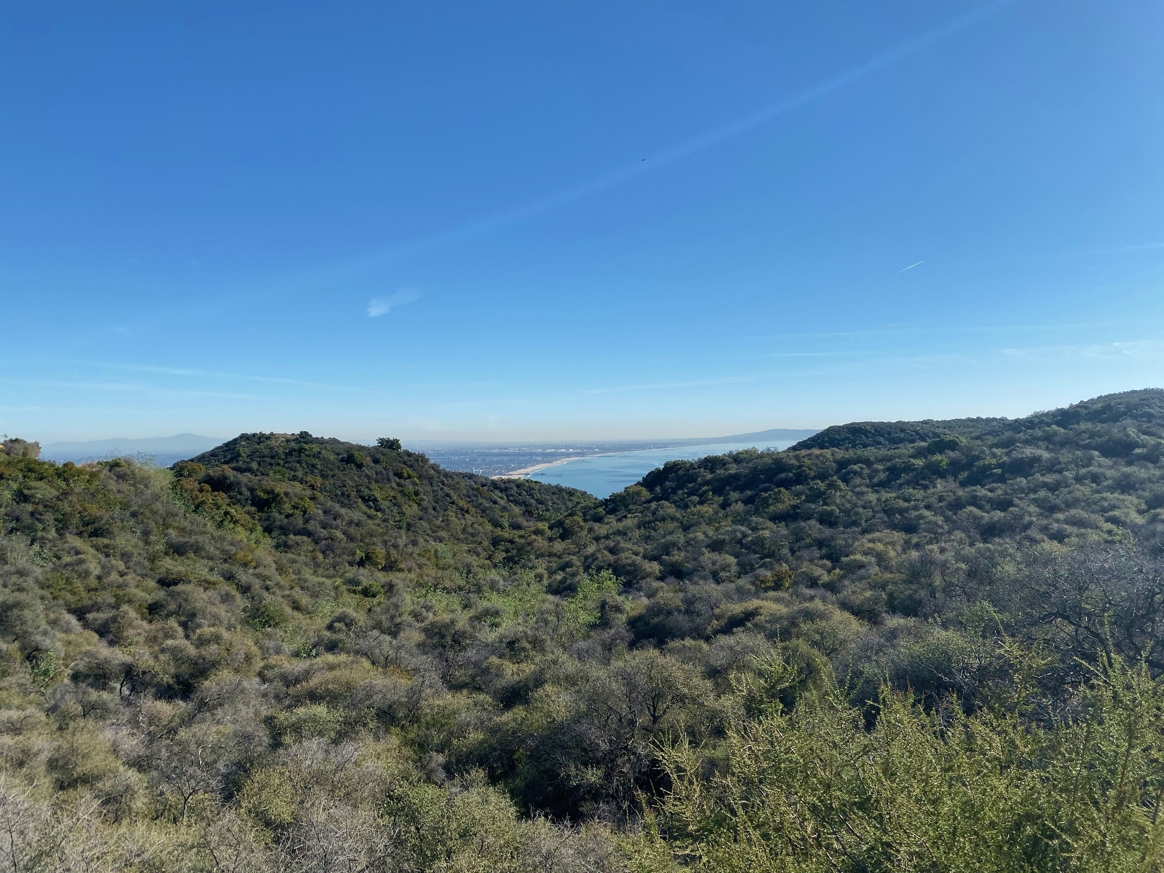
Los Liones Trail starts in Pacific Palisades, just one-third of a mile from the beach, and climbs through one of the most beautiful riparian canyons in the Santa Monica Mountains before connecting to the fire road system in Topanga State Park. The destination is Parker Mesa Overlook, a ridgetop viewpoint at 1,500 feet with panoramic views of Santa Monica Bay, the entire LA coastline, and on clear days, Catalina Island and the San Bernardino Mountains.
Topanga State Park covers 11,000 acres, the largest wildland within the boundaries of a major city in the world.
The Trail Options
Los Liones to Parker Mesa Overlook (Full Hike)
7.0 miles round trip · 1,500 ft elevation · 2.5 to 3.5 hours · Moderate-Hard
The main event. The trail breaks down into distinct sections:
Miles 0 to 1.5: Los Liones Canyon
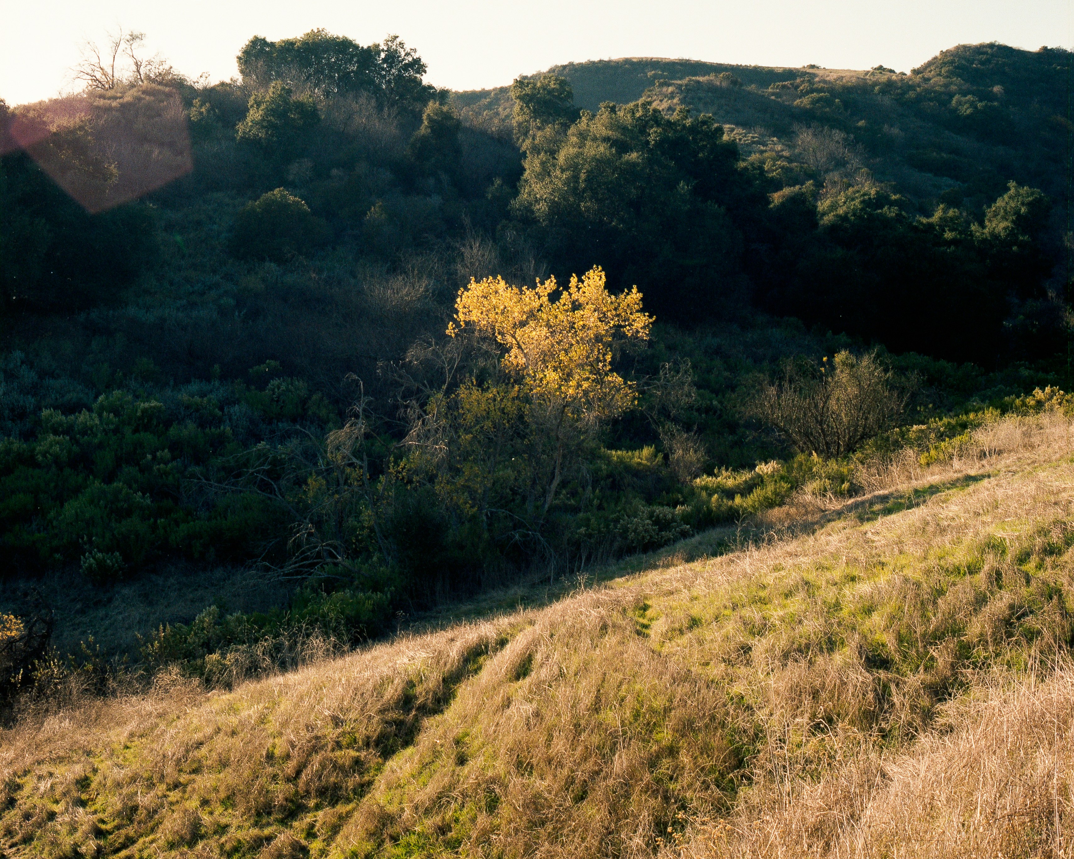
The beautiful part. Lush vegetation, ivy carpeting the canyon floor, willows, elderberries, California sagebrush, wild roses. Shaded, gently graded, with switchbacks that make the 800-foot climb manageable. First ocean views after about a third of a mile.
Mile 1.5: The Junction
Los Liones Trail meets the East Topanga Fire Road. Views of Pacific Palisades, Santa Monica, and the Pacific. Great turnaround for a shorter hike.
Miles 1.5 to 3.0: East Topanga Fire Road
Wide, exposed fire road. Chaparral landscape, toyon, scrub oak, yucca. Steeper, less varied, fully exposed. This is where the workout happens. Views keep expanding as you climb.
Miles 3.0 to 3.5: Parker Mesa Spur
Half a mile along a ridge with ocean views the entire way. The overlook has a bench and 360-degree views.
Los Liones to the Junction Only
3.0 miles round trip · 800 ft elevation · 1 to 1.5 hours · Easy-Moderate
Gets you the best part of the trail (the canyon) plus ocean views at the junction. Good for beginners or people with kids.
Parker Mesa via Paseo Miramar
5.0 miles round trip · 900 ft elevation · Moderate
Start from the top of Paseo Miramar (one street east of Los Liones Drive) to skip the canyon and start directly on the fire road. Cuts 1.0 miles off but you miss the best part of the hike.
Getting There
Trailhead address: 560 Los Liones Drive, Pacific Palisades, CA 90272
Directions: From Pacific Coast Highway, turn east onto Sunset Boulevard. After 0.3 miles, turn left onto Los Liones Drive. The turn comes up fast and it's not a major intersection. Watch for it. The trailhead is 0.3 miles down Los Liones Drive at a clearly marked gate with a stone wall.
Parking: Free street parking along Los Liones Drive, plus two small spillover lots near picnic areas. Fills up on weekend mornings. Arrive before 8am.
Alternate trailhead (Paseo Miramar): 900 Paseo Miramar, Pacific Palisades, CA 90272. Free street parking on the west side of Paseo Miramar.
⚠ Car Break-In Warning
Multiple hikers have reported break-ins at the Los Liones trailhead. Do not leave valuables visible in your car. Take everything with you or lock it in the trunk before you arrive, not at the trailhead where people can see you doing it.
What to Know Before You Go
- No dogs. Dogs are not allowed on trails in Topanga State Park. Leave the pup at home.
- The fire road is fully exposed. Bring 2 to 3 liters of water minimum, sunscreen, and a hat. On hot days, stick to the canyon portion or go early.
- Best conditions: 2 to 3 days after rain. Smog clears and visibility is extraordinary, sometimes from Santa Barbara Island to the San Bernardinos.
- Spring is peak season (March to May). The canyon fills with California brittlebush (yellow flowers), purple nightshade, desert wishbone flowers, and California manroot.
- Wildlife: Bobcats, coyotes, and mountain lions live in these mountains. Rattlesnakes are more common. Stay on the trail and watch where you step.
- Cell service: Spotty in the canyon. Download offline maps before you go.
- Restrooms: Available near the trailhead at the picnic area.
- Hours: Sunrise to sunset. Free entry from the Los Liones trailhead.
Post-Fire Trail Conditions (2025)
The Palisades Fire (January 2025) affected areas adjacent to this trail. Los Liones itself sustained minimal damage and was cleared by State Parks in March 2025. Recent hikers (February 2025) report the trail is open, green, and lush with recovery growth.
The views from the fire road are actually different and arguably better post-fire, more open sightlines where vegetation burned away. The canyon floor has largely recovered. Note that some connecting trails toward the Palisades closure areas may still be restricted. Stick to the Los Liones → Parker Mesa route as described.
The Vibe
Los Liones is a real hike. It's not the Hollywood social scene of Runyon Canyon or the tourist crowd at Griffith. The people here are hikers, trail runners, and locals who know the Santa Monica Mountains. It's popular enough that you won't be alone, but quiet enough that you'll have stretches of trail to yourself, especially on weekday mornings.
The canyon section genuinely feels like you've left the city. The fire road section feels like a workout with a view. And Parker Mesa Overlook is one of those places where you sit on a bench, look at the entire Pacific coast spread out in front of you, and understand why people live in LA.
A group of 4 to 6 is ideal, enough to share the experience, small enough to fit on the single-track sections.
FAQ
Is Los Liones Trail open after the Palisades Fire? Yes. Los Liones sustained minimal damage and was cleared by State Parks in March 2025. As of February 2025, the trail is open and lush with new growth. Temescal Canyon and other nearby Westside trails remain closed indefinitely.
What happened to Temescal Canyon? Temescal Canyon Trail remains closed following the January 2025 Palisades Fire. Los Liones Trail to Parker Mesa Overlook is the best open alternative for Westside ocean-view hiking. Check parks.ca.gov for current Temescal Canyon status.
Are dogs allowed? No. Dogs are not permitted on Topanga State Park trails, which includes Los Liones.
How hard is the hike? The full Parker Mesa hike (7.0 miles, 1,500 ft gain) is moderate-hard. The canyon-only option (3.0 miles, 800 ft) is easy-moderate and doable for most fitness levels. The fire road section is the grind, fully exposed and steeper than the canyon.
Is parking free? Yes. Free street parking on Los Liones Drive and small spillover lots. No fee, no permit. Arrive before 8am on weekends.
Is it good for a group hike? It's excellent. A group of 4 to 6 is ideal, enough to share the experience, small enough for the single-track canyon sections. Free, ocean views at the top, and the trail is just challenging enough to feel like an accomplishment.
How hard is the Los Liones trail? The Los Liones trail is moderate to challenging. The trail gains significant elevation over about 3.5 miles to the Parker Mesa Overlook, with some steep switchbacks.
Can you see the ocean from Los Liones? Yes, the Parker Mesa Overlook at the top of the Los Liones trail offers one of the best panoramic ocean views in all of LA, stretching from Malibu to the Palos Verdes Peninsula.
Last verified: February 2025. Trail conditions post-fire can change. Check Topanga State Park status at parks.ca.gov or the Santa Monica Mountains Task Force (smmtf.org) for the latest trail updates before heading out.